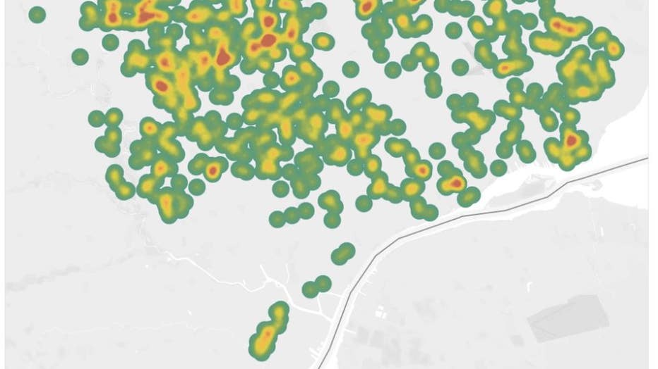
Detroit Health Department heatmap shows coronavirus hotspots in city
DETROIT - With Detroit's coronavirus tallies reaching the upper echelons of the country's worst-hit cities, it might be helpful for residents to track where those cases are coming up.
The city's health department has released a heat map showing hotspots within the city where COVID-19 has been confirmed.
Where state data only confirms the country that coronavirus is spotted, people that live in urban pockets where coronavirus will flare up might benefit from seeing a more localized breakdown of just where coronavirus is in Detroit.
As of Friday morning, the city had confirmed 919 cases of coronavirus and 22 deaths - more than any other county in the state.

Other numbers the city has reported:
- Residents over the age of 60 make up 45.8% of the cases
- Women are 51.5% of cases, men are 48.2% of cases
- Between March 11 -18, only 48 cases had been confirmed. Since then, More than 800 cases have been confirmed.
While many factors are in play that will determine how the coronavirus will spread, it's generally assumed that municipalities with more public and private locations where people interact will magnify the spread of the virus.
It's also assumed that elderly residents and individuals with underlying conditions are more at risk for extreme cases of coronavirus.
Not only does Detroit have both, but it's also a socioeconomically-depressed city, which is a key indicator for finding demographics with more underlying conditions.
RELATED: Detroit and Wayne Co. make up half of Michigan’s coronavirus cases – here's why it's the epicenter
"Part of what we're seeing in Detroit is that there's such a high number of individuals who have those underlying conditions - who have diabetes and the heart disease, who may have obesity," said Dr. Joneigh Khaldun, the chief medical executive at Michigan's health department during a Thursday news conference.
The city has actively worked to provide food and services to individuals who may struggle to access those provisions as the state goes into a more restrictive state following executive orders from the Michigan governor to close all nonessential businesses.
You can find the map here.

