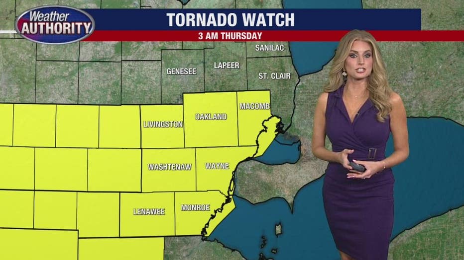
Tornado watch issued for most of SE Michigan until 3 a.m.

FOX 2 (WJBK) - Most of Southeastern Michigan is under a tornado watch until 3 a.m. Thursday.
A flood watch is also currently in place for our area with one to three inches of rainfall possible. Two Metro Detroit counties in particular - Oakland and Livingston have flood warnings until 3 a.m.
A tornado watch means that the ingredients for a tornado are in play, but just scattered storms appear to be the biggest problem along with heavy rainfall.
Livingston County had a tornado warning earlier this morning, but it was canceled by the National Weather Service after 15 minutes.
Storms are expected to begin around midnight until 3 a.m. Torrential downpours have developed with these storm cells with 1 to 2 and a half inches of rain.
According to the NWS says between 2 and 3.5 inches of rain have fallen from earlier thunderstorms. The rain is quickly coming to an end. It will however take several hours for water to recede.
Additional rainfall amounts of less than a half inch are expected.
Strong thunderstorms are developing as part of the storm system. Flooding, damaging winds with gusts up to 40 to 50 miles an hour are expected.
The same storm system rolled through Chicago with numerous reports of tornadoes earlier on Wednesday evening.
Around 6 p.m., the National Weather Service confirmed a tornado was on the ground near O'Hare Airport. A ground stop was issued and people at the airport were reportedly sent to a shelter in a downstairs tunnel.

Riding in the Weather Beast with Metro Detroit under a tornado watch until 3 a.m.
Derek Kevra is on the road in the FOX 2 Weather Beast.
Download the FOX 2 Weather App, it's free HERE.