


Tropical Storm Bertha moves across northern Gulf toward Texas
AN UPDATED VERSION OF THIS STORY HAS BEEN MOVED HERE.
AN UPDATED VERSION OF THIS STORY HAS BEEN MOVED HERE.
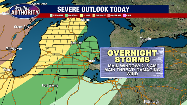

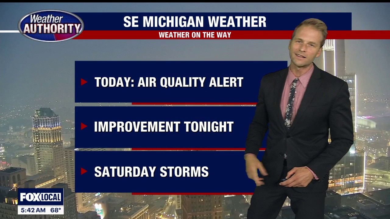
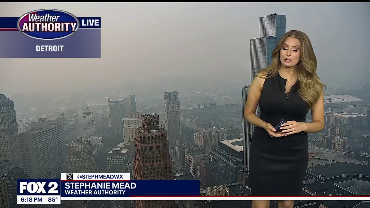
Metro Detroit Weather: Air quality will worsen Monday, storms arrive overnight
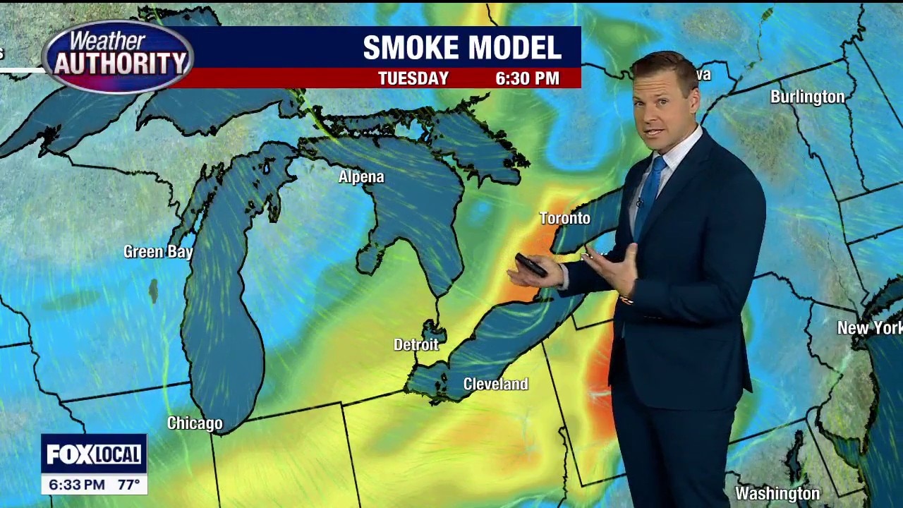
Once we deal with the current Air Quality Alert for Monday, then our attention turns to storms arriving late tonight.
Once we deal with the current Air Quality Alert for Monday, then our attention turns to storms arriving late tonight.
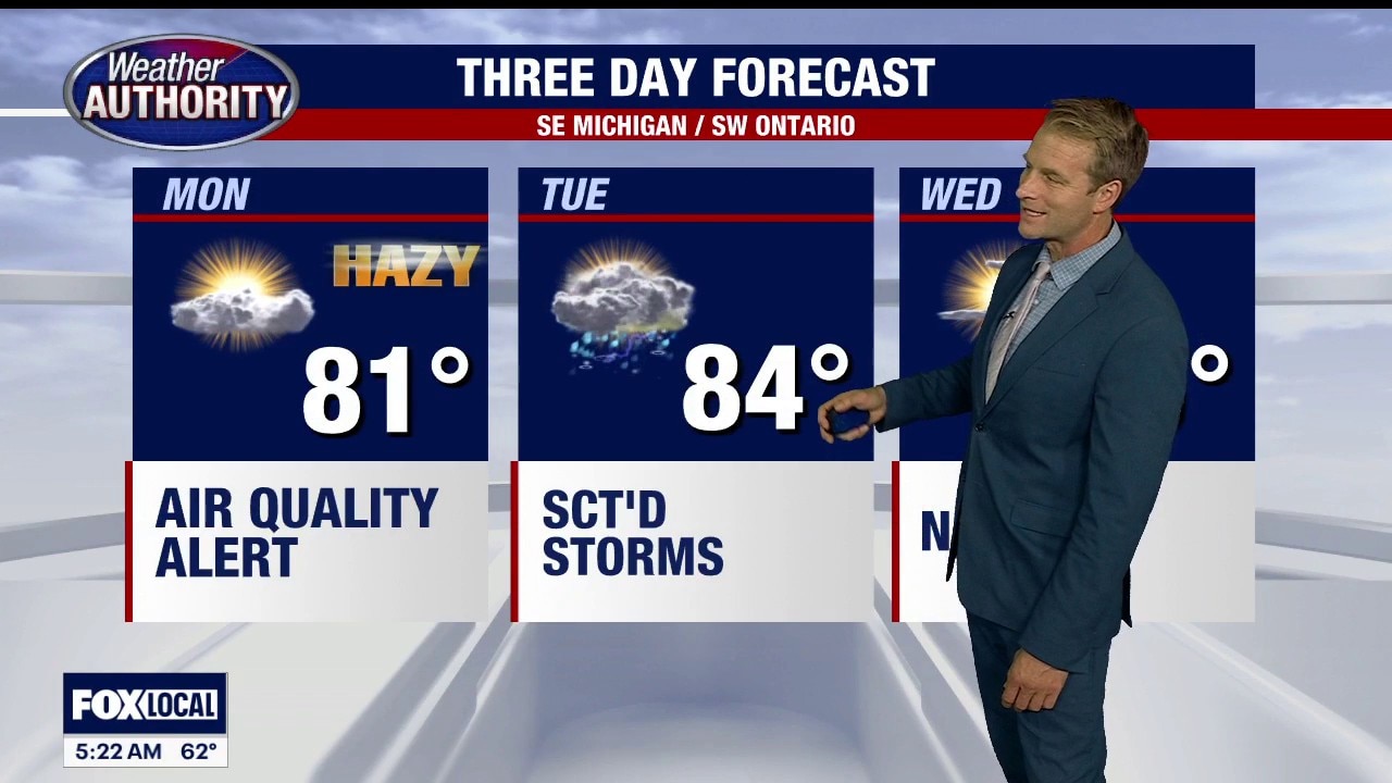
Air Quality Alert for Monday
Alan Longstreet has the forecast.
Alan Longstreet has the forecast.
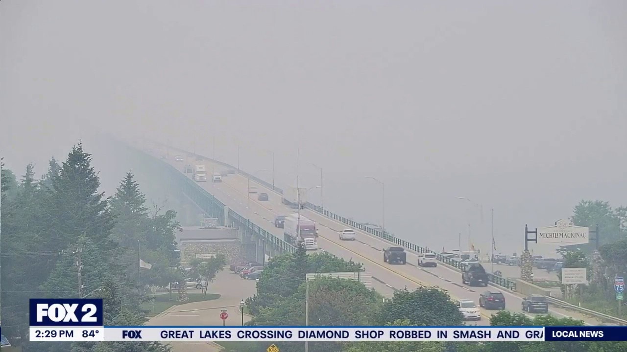
Smoke lingers although it's not as bad as last week
AQI's are in the range of 100-120
AQI's are in the range of 100-120
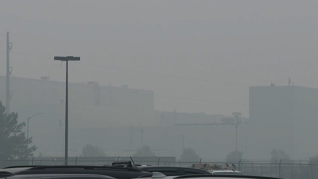
Smoke has returned to Michigan
It's not as bad as last week but still unhealthy for some
It's not as bad as last week but still unhealthy for some
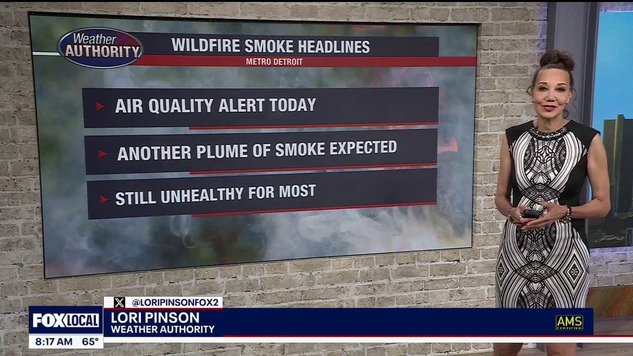
Air Quality Alert Statewide Today
Poor air quality once again today as another plume of smoke moves across Michigan. Cooler day ahead. Meteorologist Lori Pinson has your forecast.
Poor air quality once again today as another plume of smoke moves across Michigan. Cooler day ahead. Meteorologist Lori Pinson has your forecast.
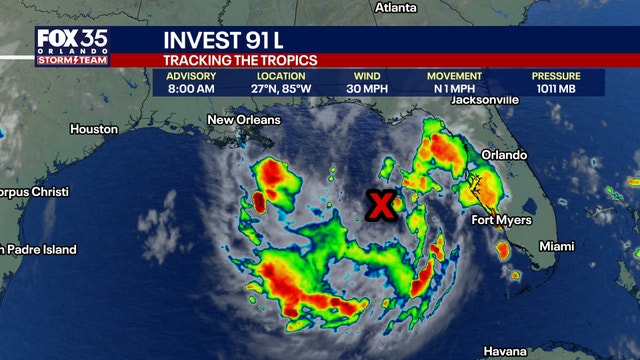

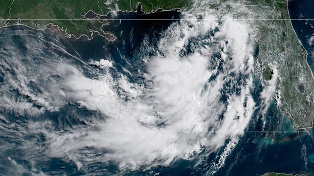
Tropical Depression 2 forms in the Gulf, NHC says
Tropical Depression 2 forms in the Gulf, NHC says
Tropical Depression 2 forms in the Gulf, NHC says
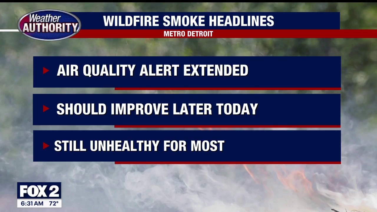
Air Quality Alert
The Air Quality Alert has been extended through today for smoke from the Canadian wildfires. Some improvement could occur once a cold front goes through today and changes our wind direction. Meteorologist Lori Pinson has your forecast.
The Air Quality Alert has been extended through today for smoke from the Canadian wildfires. Some improvement could occur once a cold front goes through today and changes our wind direction. Meteorologist Lori Pinson has your forecast.


Severe thunderstorm watch issued for 12 southeast Michigan counties as wildfire smoke lingers
A severe thunderstorm watch remains in effect for much of southeast Michigan through Saturday evening, with damaging winds, large hail and an isolated tornado possible.
A severe thunderstorm watch remains in effect for much of southeast Michigan through Saturday evening, with damaging winds, large hail and an isolated tornado possible.

Detroit air quality: Less smoky weekend but not clear
The air in Detroit improved overnight and into the early weekend, but poor conditions may return again Saturday night.
The air in Detroit improved overnight and into the early weekend, but poor conditions may return again Saturday night.
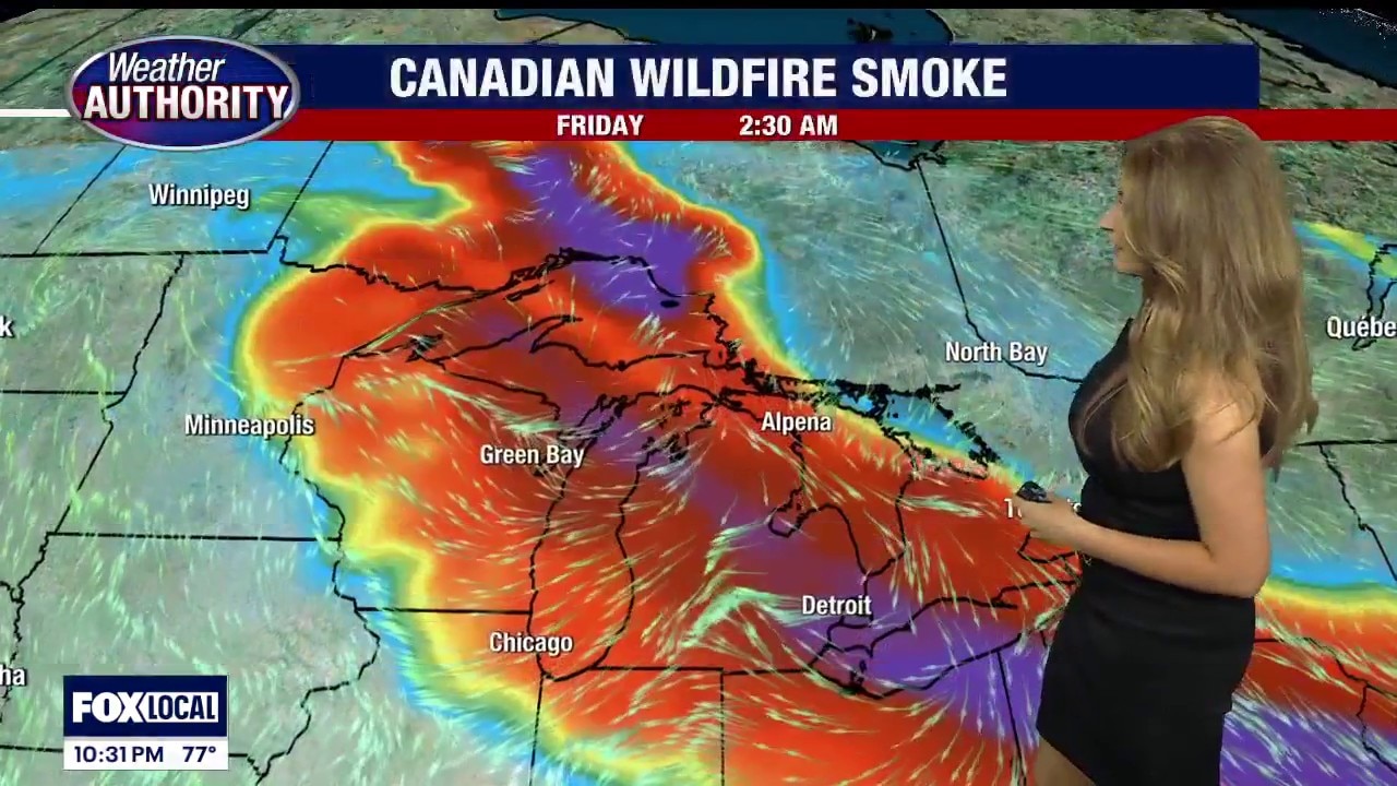
Smoke continues Friday and into the weekend
Air Quality Alert extended through Saturday
Air Quality Alert extended through Saturday


Thunder Over Michigan: Air show continuing amid wildfire smoke
The Thunder over Michigan air show is continuing this weekend at Willow Run Airport. Here’s what to know about the event and the air quality alert.
The Thunder over Michigan air show is continuing this weekend at Willow Run Airport. Here’s what to know about the event and the air quality alert.

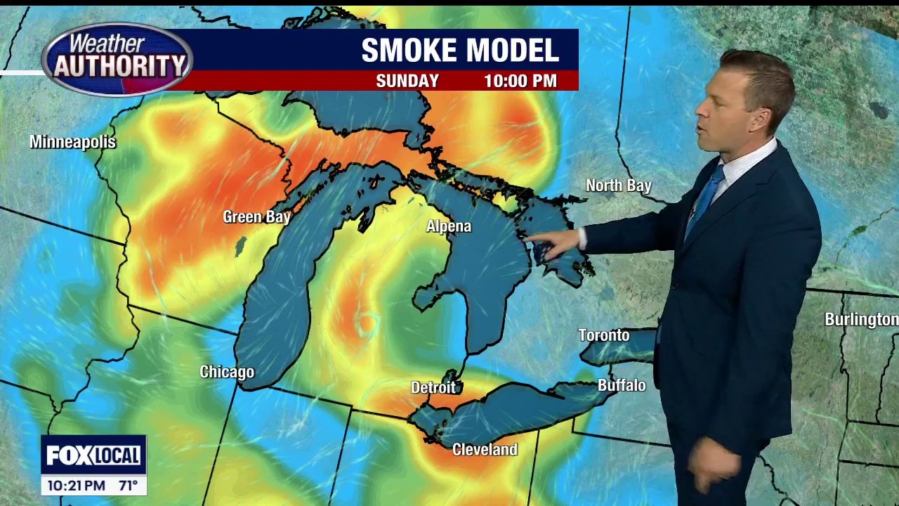
When will Michigan skies clear? Wildfire smoke could depart temporarily
Caught between extreme heat, hazy skies, and some of the world's worst air quality, Michigan is desperate for some respite from what has been a brutal stretch of weather in July.
Caught between extreme heat, hazy skies, and some of the world's worst air quality, Michigan is desperate for some respite from what has been a brutal stretch of weather in July.
Detroit air quality ranked worst in world again Friday
An Air Quality Alert remains in effect for Michigan on Friday, and Detroit's air is ranking worst in the world again.
An Air Quality Alert remains in effect for Michigan on Friday, and Detroit's air is ranking worst in the world again.


What is Code Purple air quality? What Code Orange, Red and Purple mean
Air quality alerts can change quickly during wildfire smoke events. Here’s what Code Orange, Code Red, Code Purple and Code Maroon mean, and when you should limit time outside.
Air quality alerts can change quickly during wildfire smoke events. Here’s what Code Orange, Code Red, Code Purple and Code Maroon mean, and when you should limit time outside.


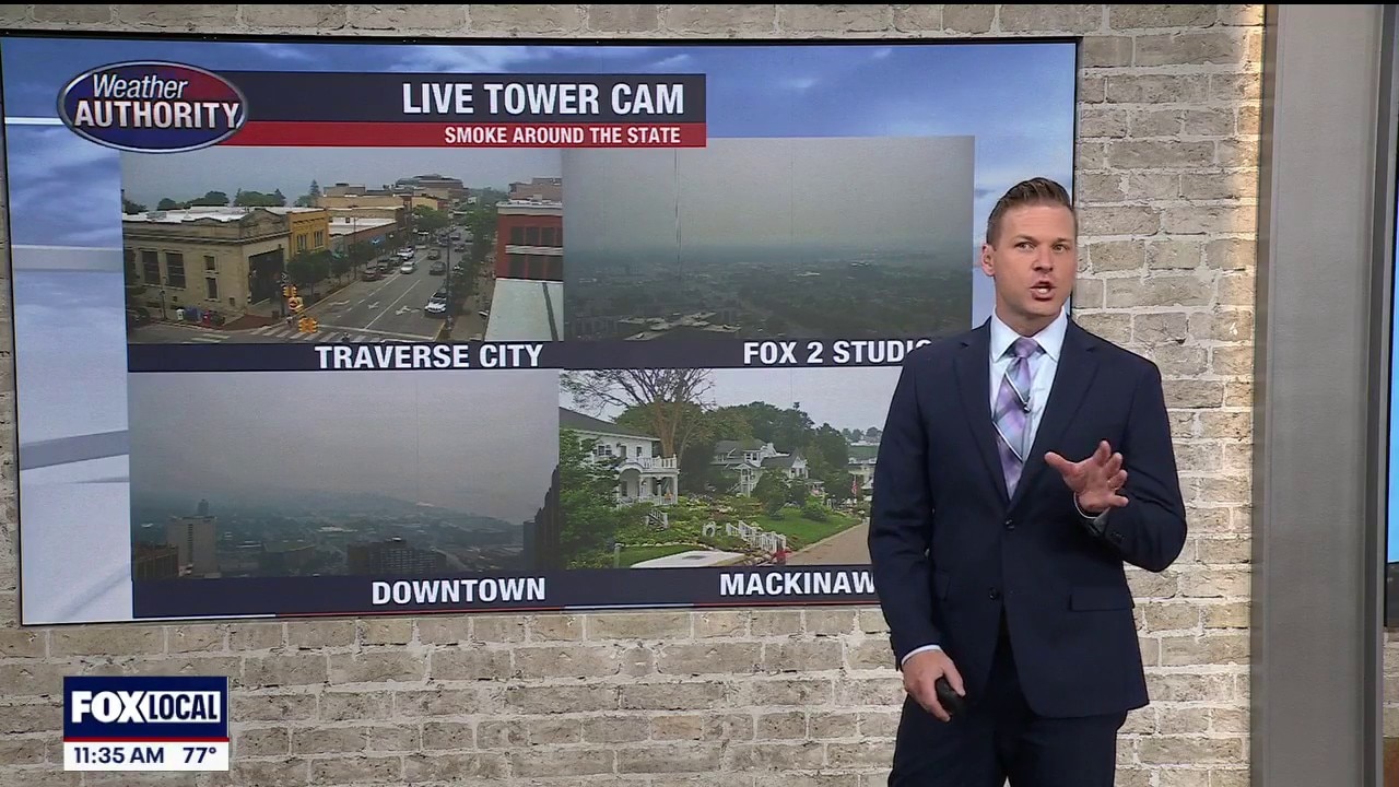
Detroit air quality map, timeline: Smoke to lessen tonight into weekend
An Air Quality Alert is in effect for our area as the Canadian wildfires continue. While conditions from the smoke remain awful, there is some relief in store, tonight.
An Air Quality Alert is in effect for our area as the Canadian wildfires continue. While conditions from the smoke remain awful, there is some relief in store, tonight.
Air quality improves little by little; possible storms tonight and Saturday
Alan Longstreet has the latest on the Air Quality Alert for Michigan as Canadian smoke from wildfires blanket the region.
Alan Longstreet has the latest on the Air Quality Alert for Michigan as Canadian smoke from wildfires blanket the region.
Some relief from wildfire smoke on the way for Michigan
Michigan will get at least a little reprieve from the wildfire smoke late Friday and early Saturday before it moves back in over the state later in the weekend.
Michigan will get at least a little reprieve from the wildfire smoke late Friday and early Saturday before it moves back in over the state later in the weekend.
Smoky Friday
Smoke sticks around through Friday. Storm chances are around through the evening.
Smoke sticks around through Friday. Storm chances are around through the evening.
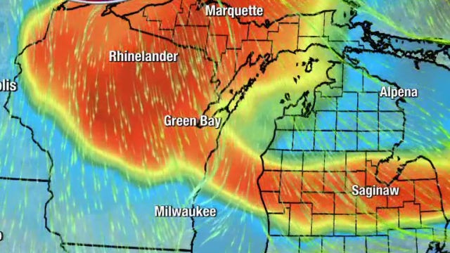
When will we see relief from Canadian wildfire smoke?
Air quality is poor across Michigan, and many are wondering when we could see some relief. Meteorologist Derek Kevra gives a science lesson and provides that answer.
Air quality is poor across Michigan, and many are wondering when we could see some relief. Meteorologist Derek Kevra gives a science lesson and provides that answer.