Detroit weather: Winter Weather Advisory issued as snow, rain, and winds expected Tuesday
Winter Weather Advisory Tuesday morning
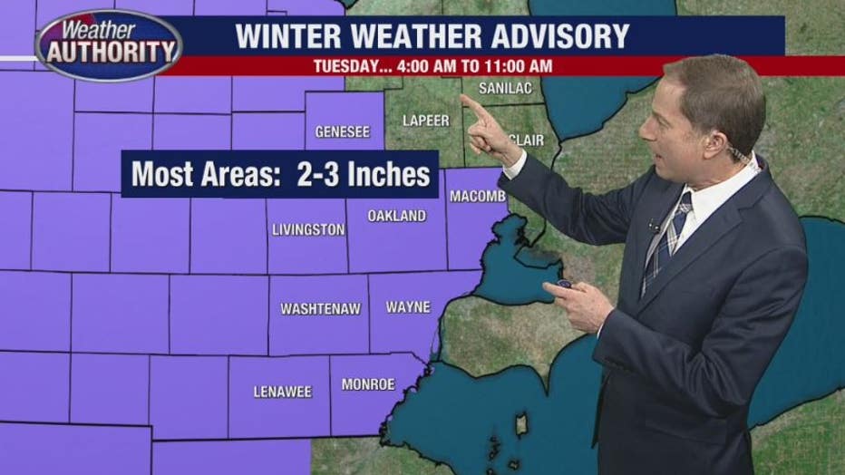
Metro Detroit is under a Winter Weather Advisory on Tuesday. Snow will fall in the morning before turning to rain as temperatures rise. 1-3 inches is expected.
DETROIT (FOX 2) - December 1 marks what's called "meteorological winter" which is typically when winter weather starts to really ramp up in Michigan. But since then, we've seen only 1.1 inches of snow and significantly above-average temperatures. That's all about to change.
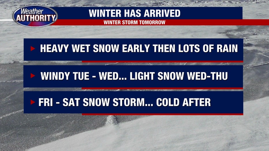
A dynamic winter storm is on its way here and will affect us Tuesday through Wednesday.
Track the weather wherever you are with the FOX 2 Weather App. It's completely free and shows live radar, temperatures, incoming weather, and so much more. It also works anywhere in the world! Wherever you go, take the FOX 2 Weather App with you.
Winter Weather Advisory
The National Weather Service announced a Winter Weather Advisory for Southeast Michigan from 4 a.m. to 11 a.m. on Tuesday.
The message came Monday afternoon with expectations of wet snow and up to 5 inches of precipitation in some spots.

When will the snow start in Metro Detroit?
Beginning as early as 2:00 Tuesday morning we could start to see heavy wet snow falling. When we wake up Tuesday morning, we'll see the big heavy flakes until around 10 a.m.
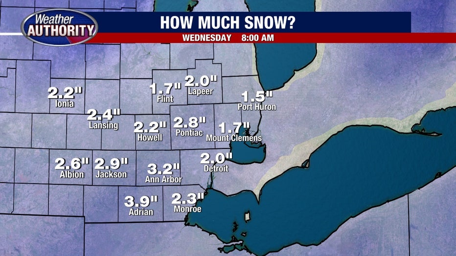
By that point, we could have between two and three inches of heavy, wet snow on the ground.
The fact that this coincides with a Tuesday morning commute could mean a rough drive to work for many of us. So perhaps give yourself a little extra time to get in.

When will the snow stop?
Starting around 10:00 a.m., the snow will transition into rain as temperatures get into the lower 40s. This rain could get heavy at times and the forecast is for over one inch of rain. But, because of the temperatures getting above freezing, it will only be rain and not snow.
Incidentally, if it was freezing, we'd be looking at close to ten inches of snow!
The fact that this is falling on top of heavy wet snow could mean that areas prone to flooding may do just that. Keep an eye on those basements.

What else to expect with the winter weather?
We'll have snow, we'll have rain, but we'll also have strong winds.
Power outages are a possibility as the wind speeds will increase to 30 or 35 mph. Heavy, wet snow early could mean power lines and tree branches are way down and the winds will not help.
Tuesday night into Wednesday we will see a transition back to snowflakes, but big accumulation is unlikely. In fact, probably just another half inch to 1 in while the winds remain elevated.

Thursday brings a quick smaller system with another inch of snow possible.
Attention then turns to Friday and Saturday where the next large winter storm takes. Amy Michigan. This one could bring much more snow and equal, if not stronger, wind gusts.

