

Metro Detroit winter weather: Heavy snow, strong winds expected Friday into Saturday
DETROIT (FOX 2) - Our first real winter storm is set to impact us Friday afternoon into Saturday night. Lots of details to get to, so stick with me.
Getting to work Friday will be no problem as the pattern is calm but cloudy. Temperatures gradually build through the middle 30s.
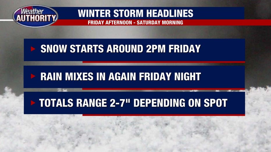
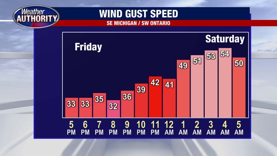
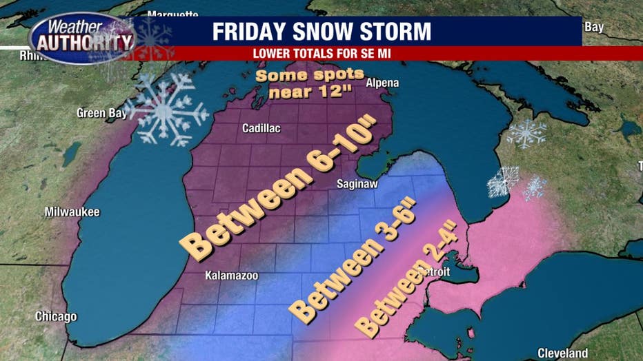
Beginning around 2 p.m. snow will push in from northern Indiana and northern Ohio - beginning our winter storm event. Several hours of heavy snow is expected between 2 and 7 p.m. Friday. The commute home is shaping up to be a mess as the snow will likely stick despite the fact that temperatures remain in the middle - and possibly even upper - 30s. Winds will start to pick up as well, gusting to nearly 30 mph.
Beginning around 7 p.m. we expect a changeover from snow to rain. This transformation will have an overall effect on total snow numbers, causing plenty of Southeast Michigan to fall in the range of 2-4 inches. Some dryer air could mix in late Friday evening and Friday night as well. Areas north and west of the city will likely see more snow however, instead falling into the 4-7 inch range.
Track the weather wherever you are with the FOX 2 Weather App. It's completely free and shows live radar, temperatures, incoming weather, and so much more. It also works anywhere in the world! Wherever you go, take the FOX 2 Weather App with you.
By 1-2 a.m. Saturday morning we will transition back to snowflakes as cold air wins the battle (and war). Snow will continue to fall early Saturday morning. Winds will peak at this time too. Gusting to nearly 50 mph. Strong winds such as this for a prolonged period of time, has a threat for power losses.
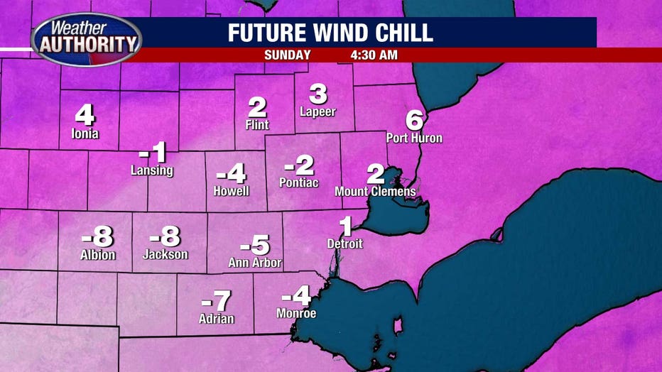
Saturday will be chillier and icier as temperatures drop into the lower 30s. Winds remain strong for most of Saturday with the wind chills expected to be in single digits.
Sunday is when the frigid air arrives, dropping down to 15° yet wind chills below zero all day long. Flurries are possible Sunday as well. Lions fans headed down to tailgate and attend the game should bundle up to the max and use plenty of layers and portable heaters if possible.
Overall, Southeast Michigan's biggest threat from the system will not be the large snow numbers. Instead, the constant mix of winter precipitation and strong prolonged winds. The frigid air next week will stick around as well.