

Michigan Severe Weather: Tornado Warnings end for Metro Detroit; 264k without power
(FOX 2) - The latest bout of bad weather that hammered Southeast Michigan has moved on with hundreds of thousands without power, several now-concluded tornado warnings, and a lot of cleanup.
DTE: Power outage across region
The latest round of storm damage left Southeast Michigan with without power everywhere.
You can see the latest reports here: outage.dteenergy.com/map.

DTE Power Outages: Hundreds of thousands impacted by storm
Already reeling from one round of storms the previous evening, people all around the region were without power in the early evening. From Southern Wayne County to Northern Oakland County, all the way west on the I-96 corridor in Livingston County and Michigan Avenue in Ann Arbor reported power outages.
Storms will slow restoration
DTE Director of Operations Jerry Tullio spoke at a press conference Thursday afternoon, saying 80% of customers impacted by the first wave of the storm can expect to see service restored by the end of the day on Thursday.
As of 2:40 p.m., 110,000+ customers lacked power.
The most significant storm damage impacting service was seen along the I-96 corridor, according to Tullio.
It was also noted that more storms were coming in later in the evening and that DTE would be prepared for this. The team has 400 linemen from out of state assisting, with another 800 on their way later Thursday afternoon.
Detroit Chief of Fire Operations, David Nelson, also spoke at the press conference, stressing the importance of storm safety at this time.
Nelson stressed that people should assume power lines are electrified if you see them and to stay at least 25 feet away from any downed lines. He also said that if the line is touching anything to keep distance from that as well and ensure children are kept away.
The Detroit Chief of Fire Operations also reminded the public that if a power line has fallen on your home that you should leave your home and immediately call 911.
Detroit Officials respond to severe storms
Detroit Mayor Mary Sheffield spoke to members of the press, discussing the severe weather that flattened houses and damaged rooftops, especially on the city's eastside.
"Detroit, we experienced some incredibly severe weather this afternoon and I pray that everyone got through it safely," Sheffield said. "I was on the city's east side surveying damage from a possible tornado that touched down in the area Between E. Vernor and E. Jefferson and Mt. Elliot and E. Grand Boulevard. What I saw were a lot of severely damaged buildings and homes, down trees and powerlines. Fortunately, we have had no reports of any serious injuries at this time from that area.
"We have launched a multi-department response to this storm to support our residents to make sure they are safe and to begin the clean-up process.
"The Detroit Fire Department has been going door to door to check on residents. Our General Services Department has brought in extra crews to remove trees that have fall across streets and sidewalks or may have people blocked in their homes.
"Our DPW is responding to about 80 intersections with dark traffic lights by mobilizing generators and stop signs for safety. DPW crews also will be clearing building debris from roadways
Our Building inspectors will be surveying the area to identify any buildings that may be so heavily damaged that they could be unsafe to enter.
"And our Department of Human, Homeless and Family Services is standing by to assist any family whose home may have been damaged and is in need of emergency shelter."

Detroit Mayor Mary Sheffield speaks on severe weather damage
Detroit officials talked with news media on Thursday following severe weather slamming into the city, damaging homes and uprooting trees.
Tornado Warnings end around Metro Detroit
All of Southeast Michigan was under a tornado threat late Thursday. The National Weather Service issued warnings for the entire region, ending the alert by 4:45 p.m.
The warnings stretched along the I-96, I-275, and US-23 highways.
Detroit Metro Airport Groundstop
A ground stop was ordered for Detroit Metro Airport due to thunderstorms.
It's expected to end around 4:15 p.m.
Sirens ring out in Oakland County
Residents in Oakland County may be hearing sirens ring out amid the bad weather.
That is not a sign of a tornado warning. Instead, the county turns them on when winds strengthen enough — around 60 to 70 mph.
Forecast for the remainder of Thursday
A continued chance of precipitation will be seen late Thursday afternoon into Thursday evening.
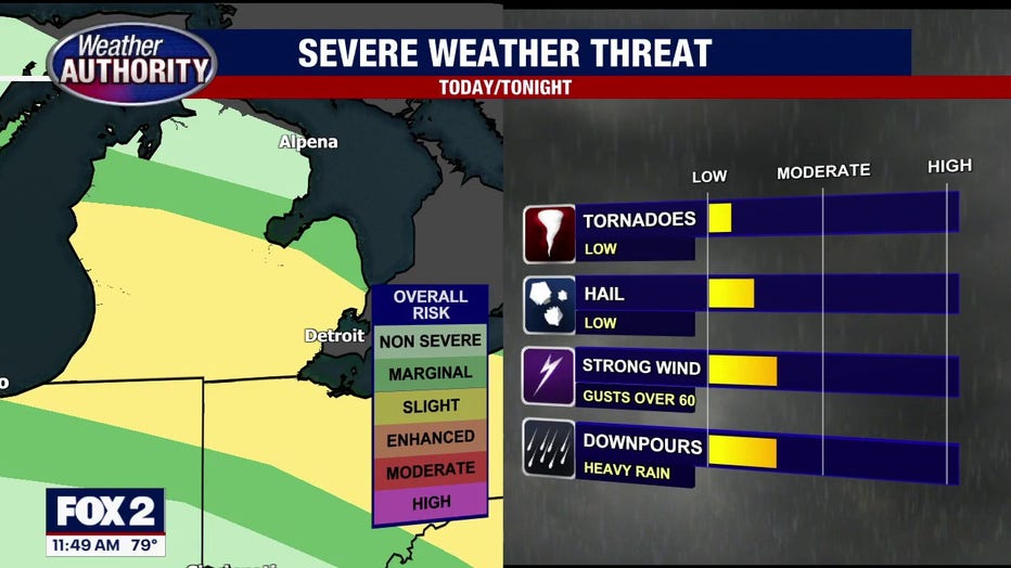
Scattered to widespread storms are expected into Thursday night throughout the Southeast Michigan area. An additional round of storms is expected very late Thursday night into early Friday morning, which could impact the early morning commute.
Temperatures are expected to remain in the low 80s and high 70s throughout Thursday, fluctuating slightly as storms potentially roll in and out.
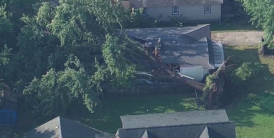
Storm damage leaves 100K without power; Warren among hardest hit
There is going to be a lot of cleanup this morning all over SE Michigan, with damage widespread.
Tornado confirmed in Marysville
The National Weather Service confirmed a tornado touched down in Marysville in St. Clair County on Sept. 2 around 7:19 p.m.
"A brief weak tornado tracked across portions of Marysville, Michigan in St. Clair County on the evening of September 2, 2026. Tree damage was sporadic along a narrow path between Gratiot Boulevard and Highway 29."
It was rated an EF-0, the lowest rated tornado, which is 65-85 mph.
School closings due to storms
There are some schools closed – CLICK HERE to see the list.
Among the school districts impacted are Howell Public Schools and Madison District Public Schools in Oakland County.
The Source: The National Weather Service was cited for this story.