Severe thunderstorm timeline: When rain, hail, strong winds arrive in Metro Detroit
Severe thunderstorms approach Metro Detroit
Severe thunderstorms will arrive Wednesday afternoon. The biggest risks include strong winds, large hail, and flooding.
DETROIT (FOX 2) - Though Metro Detroit will be dry into the early afternoon, strong and persistent thunderstorms will stick around through the night.
These storms will be impactful and have the potential to cause damage and lead to flooding.
Track severe thunderstorms in Metro Detroit: wind and hail likely, tornado possible
Around 2 p.m., a severe thunderstorm watch was issued for all of southeast Michigan, stretching from Saginaw to Port Huron and down into northern Ohio. This, of course, includes Detroit, Ann Arbor, Oakland County, and Macomb County.
Thunderstorm timeline
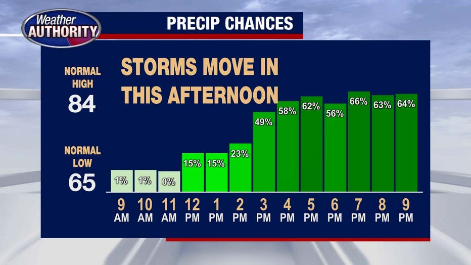
The storms could arrive in Metro Detroit as early as 2 p.m., but they are more likely to reach the area between 4 p.m. and 5 p.m. If these storms show up earlier, the severity later could be impacted.
These storms will continue through the evening and into the night, with the strongest expected around 7 p.m.
By midnight, the storms should be wrapping up.

Severe weather risks
Metro Detroit has an enhanced risk for severe weather - a 3 on a 5-point scale. This means that thunderstorms may be persistent and widespread, with intense storms possible.
Damaging winds
Winds could reach more than 65 mph.
Radar shows the potential for bowing, which would include very strong winds.
Large hail
Hail larger than an inch could fall during these storms.
Flooding
Torrential rains elevate the chances of flooding
We could see 1-2 inches of rain during the storms, with much of that falling in a short period of time.
Tornadoes
Tornadoes should also not be ruled out; tornadoes could pop up anywhere in the southeast or central part of the state.

