Southeast Michigan snow forecast: How much to expect Wednesday
(FOX 2) - Winter is coming.
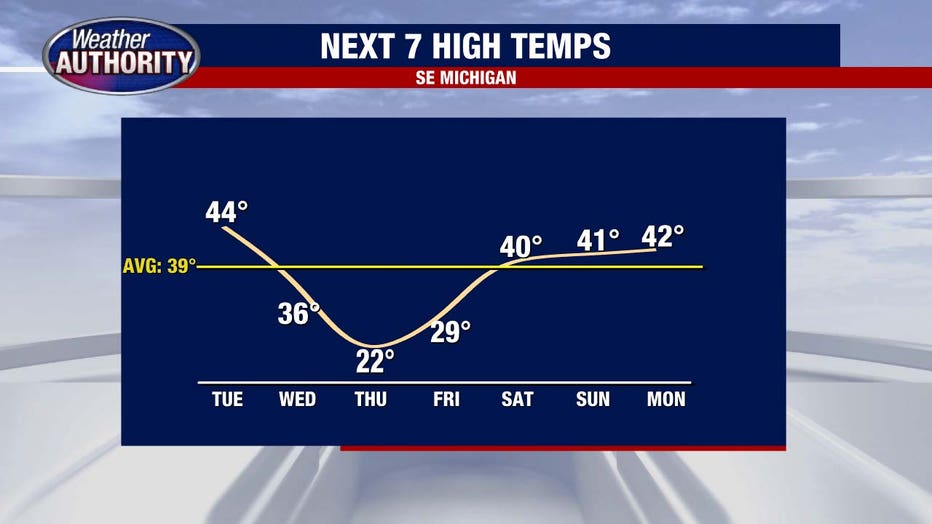
Tuesday is the calm before the cold, with temperatures slowly sliding down. We’ll manage highs in the 40s with peaks of sun between the clouds.
The real chill arrives Wednesday, bottoming out Thursday as a strong west wind keeps highs stuck in the 20s.

When will it snow?
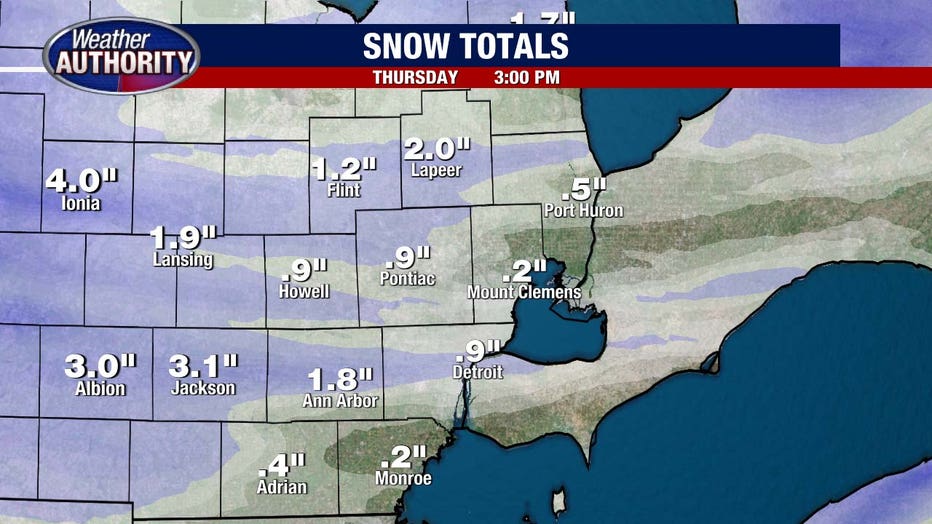
Of course, we’re all wondering about the snow. This is lake effect snow, so totals will vary from a dusting to a few inches, with heavy bursts making travel tricky at times. Let’s break it down.
First, the timing: Wednesday morning’s commute looks manageable, with just a few passing flurries. Weather-wise, no big issues.
By Wednesday afternoon, we could see a few snow showers, but coverage looks limited. From 4-7 p.m., snow doesn’t look too disruptive.
As the evening turns to night, heavier snow showers become more likely. Watch for darker blues on the radar—indicating intense, whiteout snow conditions.
The snow may linger into Thursday morning, but the bulk falls overnight. Totals will range from a dusting to 2 inches, with some localized areas possibly nearing 3 inches.
For the latest forecast, live radar, and more, download the FOX 2 Weather app.


