Southeast Michigan Weather: Heavy periods of rain underway, 2-4 inches possible
A prolonged rain event has arrived in SE MI and it will drop a lot of water right over parts of Metro Detroit. Let's get right into it.

After some heavy thunderstorms Tuesday evening the storms are transitioning to consistent moderate rain tonight and will continue through the night and tomorrow morning.

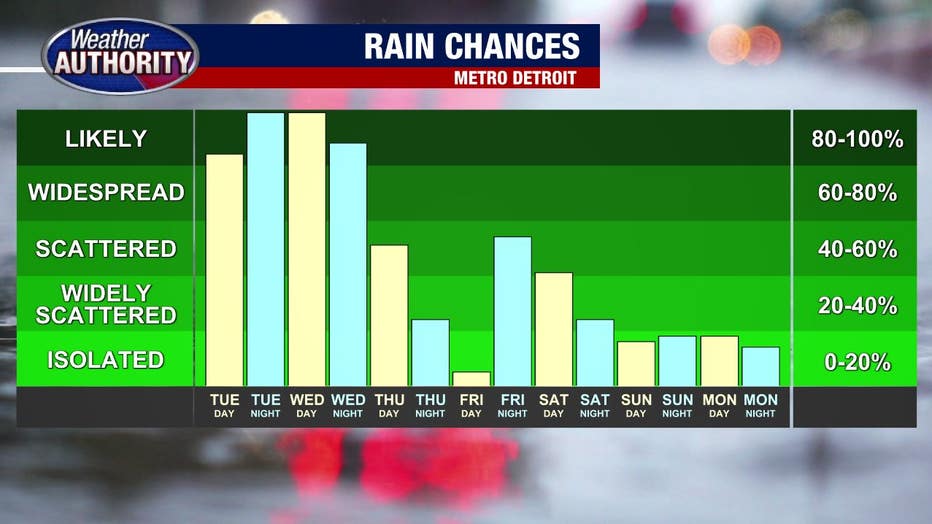
At this point I am concerned with the developing flooding threat that continues until Thursday evening. There is a high probability that it will rain ALL DAY WEDNESDAY. Perhaps a brief break may appear, but for the most part… it's going to rain.
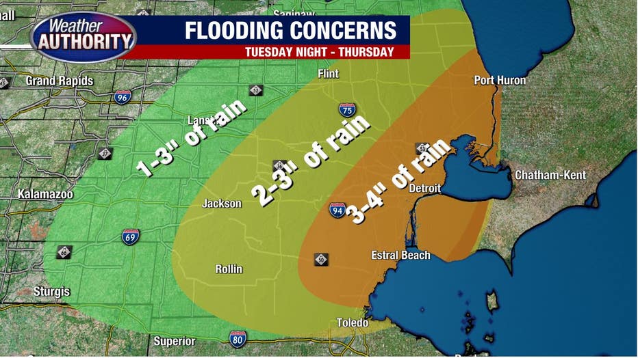
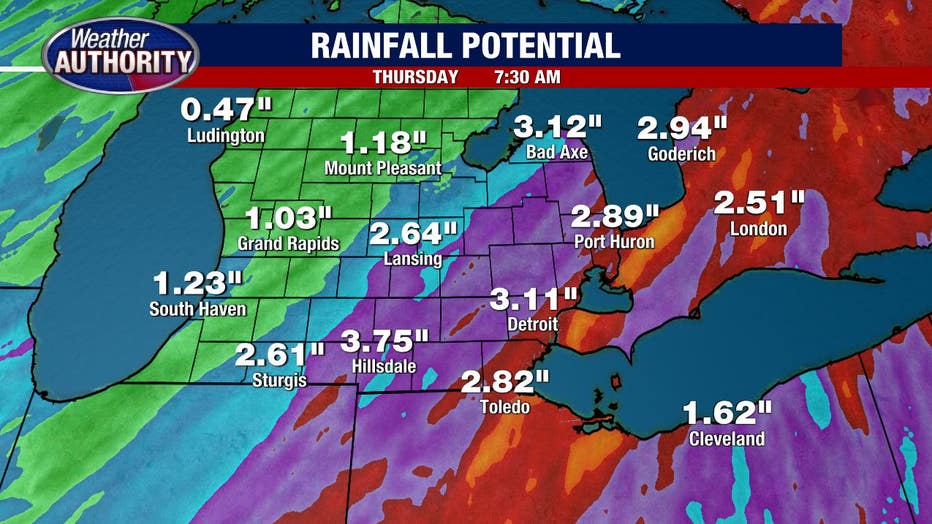
By 7 a.m. Wednesday morning most areas will pick up 1-2 inches of rain. Following that, however, we'll transition into what could be a full 24 hours of light to moderate rain. Areas in Macomb, Wayne, and Monroe could see rain totals top 4 inches.

The farther west you live, the less rain you'll see, but these 2.5-day totals are certainly impressive and scary. Most of the Metro Detroit region will get between 2-4 inches with some spots locally seeing over 4 inches.
Flooding of course is a major concern here, and a Flood Watch is likely across the whole area. We'll all be praying that our basements can avoid yet another round of rainwater.
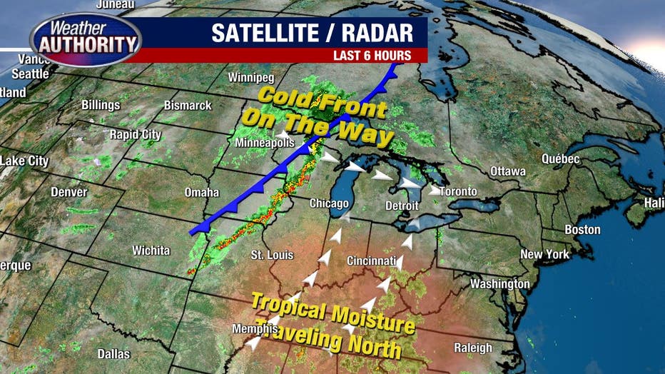
As an additional note, after the passage of Tuesday's cold front, we will see major changes to our temperatures. Highs will fall from nearly 80 on Tuesday to barely 60 on Wednesday and Thursday. We may even see these cooler numbers last into the weekend.


