

Severe storms cause flooding, leave nearly 40K residents without power in Southeast Michigan
FOX 2 (WJBK) - Despite the intense heat this week, storms slowly moved through parts of Southeast Michigan on Wednesday night.
In addition to heavy downpours, winds reaching up to 60-70 mph and penny-sized hail are possible, according to the National weather service.
A flood advisory is in effect until 11:30 p.m. for a portion of Southeast Michigan – including Macomb and St. Clair counties, near I-94, according to the National Weather Service.
Flooding blocked most lanes on westbound I-696 after Evergreen in Oakland County, according to MDOT on X. Only the right lane is open after Evergreen.
Strong winds could damage roofs, sidings, trees, and outdoor furniture.
In Roseville, a blown transformer and downed wires were reported along Roseville Blvd. An uprooted tree is also blocking a park in the area.
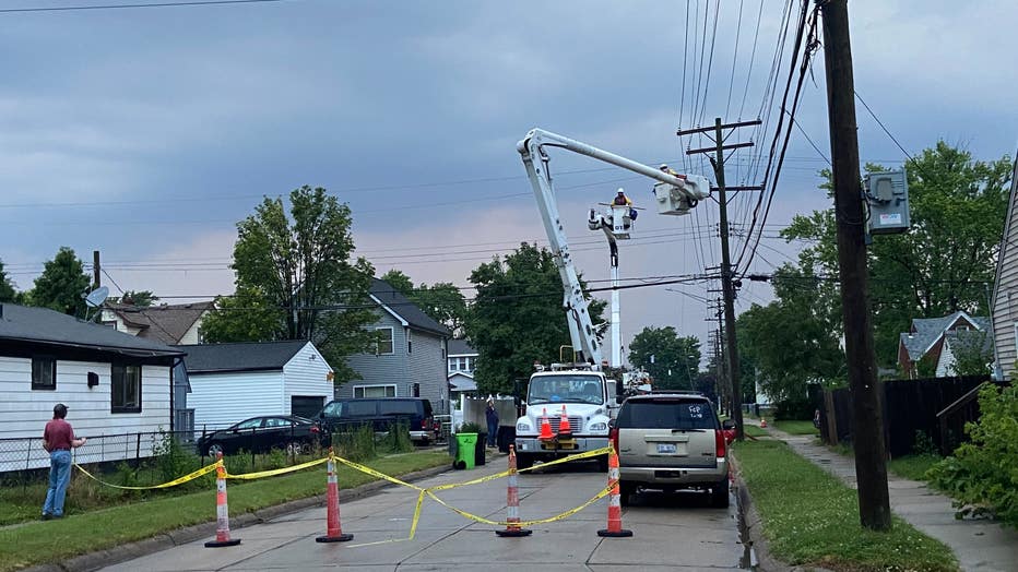
Crews work on a blown transformer along Roseville Blvd. in Roseville on Wednesday, June 19, 2024.
As of 6 a.m., 39,426 DTE customers are without power, according to DTE's outage map. That number has dropped since Wednesday night.
Off Greenfield, north of 11 Mile in Berkley, police blocked roads due to an arcing wire that flames have been sparking out of. Just south of 12 Mile, a downed tree caused damage to the roof of an apartment building.
Downed trees, arcing wire reported in Berkley due to storms
Off Greenfield, north of 11 Mile in Berkley, police blocked roads due to an arcing wire that flames have been sparking out after a storm ripped through the area.
At this time, no injuries have been reported.
Several severe thunderstorm warnings were issued for northwestern Wayne County, southeastern Macomb County, southwestern Oakland County, central St. Clair County, and northeastern Washtenaw County – all of which have since ended.
This is a developing story. Stay with FOX 2 for updates.