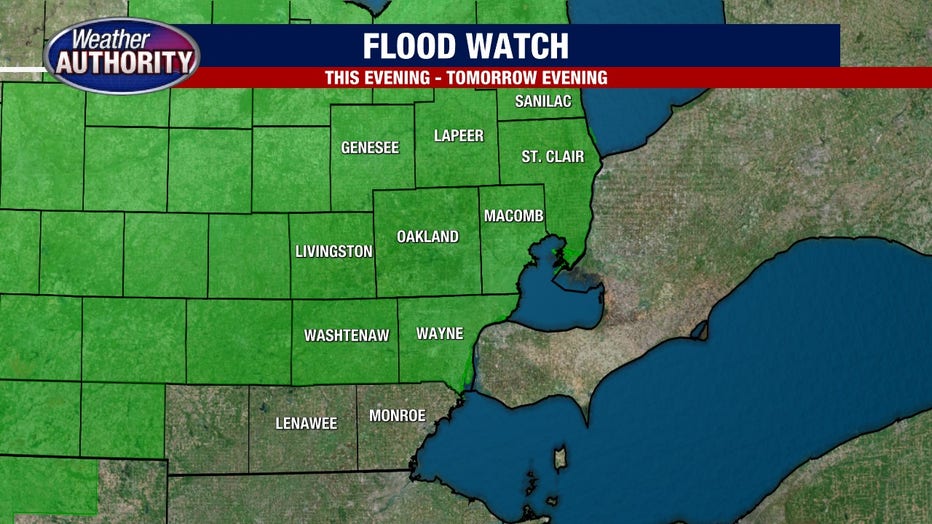
Michigan under flood watch with Hurricane Beryl bringing excessive rain this week
(FOX 2) - Hurricane Beryl was one for the record books, documented as the earliest category 5 hurricane in the Atlantic basin. And now we are bracing to feel some of its effects here in Michigan!
First things first, even though the remnants of a hurricane are moving towards us, we are not going to experience hurricane-like conditions. Winds are not a threat, nor are weaker tornadoes. Instead, we are bracing for a lot of tropical rain that could cause some flooding.
Some spotty showers are possible as we head into the afternoon and evening on Tuesday, but the heavy tropical moisture will arrive around midnight heading into Wednesday.
Between midnight and 8:00 a.m. will be our window for the heaviest rain. The rain will continue, however, through the afternoon and early evening before tapering off around 6:00 p.m on Wednesday evening.
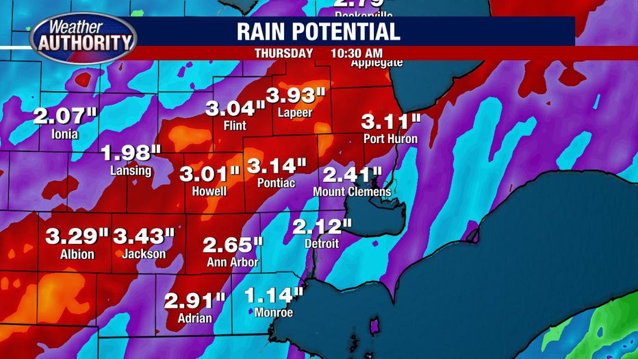
Overall, rain totals will range between 1-3 inches, but some spots locally could see as high as 4 inches. For context, 3 inches of water in the winter time would equate to 30 inches of snow! Lots of water indeed.

Now is a good time to clear those storm drains outside your house and make sure that drainage systems are in place.
Keep an eye on those basements as flooding is a possibility in all spots. Especially those areas that are prone to it.