Southeast Michigan snow totals dip due to lingering Tuesday's warmth, likely to see 5 to 8 inches
The Winter Storm Warning continues for Southeast Michigan on Wednesday and, while we'll still see a lot of snow, it's actually a bit lower than it was originally expected due to Tuesday's warm weather.
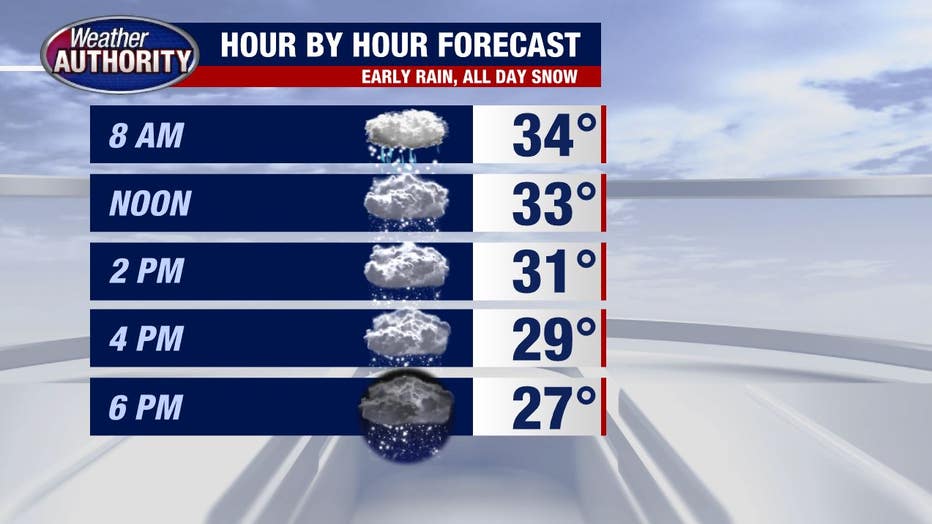
It started snowing around 9 a.m. for most of Southeast Michigan. When will it stop? Not until Thursday. The good news, however, is that the warm air we had on Tuesday is going to cut into the totals a bit.
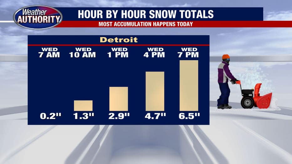
On the low end, some people will see 5 inches of snow. On the high end, close to the Ohio border, they're likely to see closer to 7 inches of snow.

The leftover "warmth" from yesterday's spring feel - a high temperature of 46 degrees - pushed the snow start time back as late as 8 or even 9 a.m. for some of our eastern communities.
Timeline: How much snow to expect and when

Snow totals looked to range between 8 and 12 inches area wide, with the highest to the south and lowest to the north. However, the warm weather kept the snow from falling earlier and the system started to track farther south of Metro Detroit.
More: How to drive in a snowstorm
The second surge of potential snow for Thursday has been looking less and less likely with most of that 8-12 inches falling by tomorrow morning.

