Temperatures remain freezing with possible snow Thursday
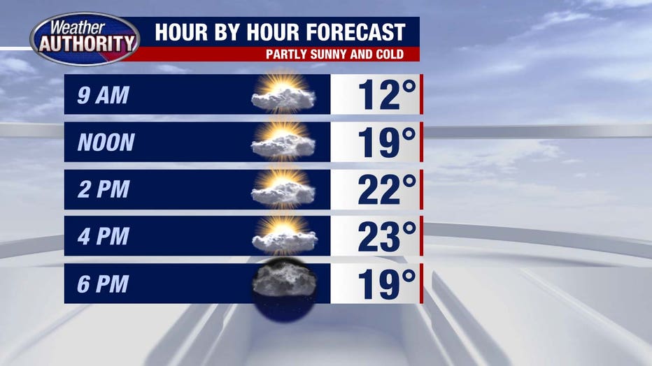
(FOX 2) - It's a bitter cold start to the day yet again. Wind chill values are hovering on either side of zero, but we'll squeeze out sun as the day progresses.
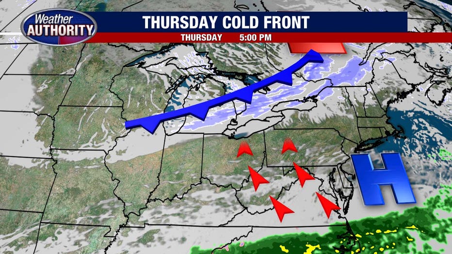
High pressure slips away from the area tomorrow and a cold front approaches, kicking our temperatures up a touch and introducing the next chance for snow.
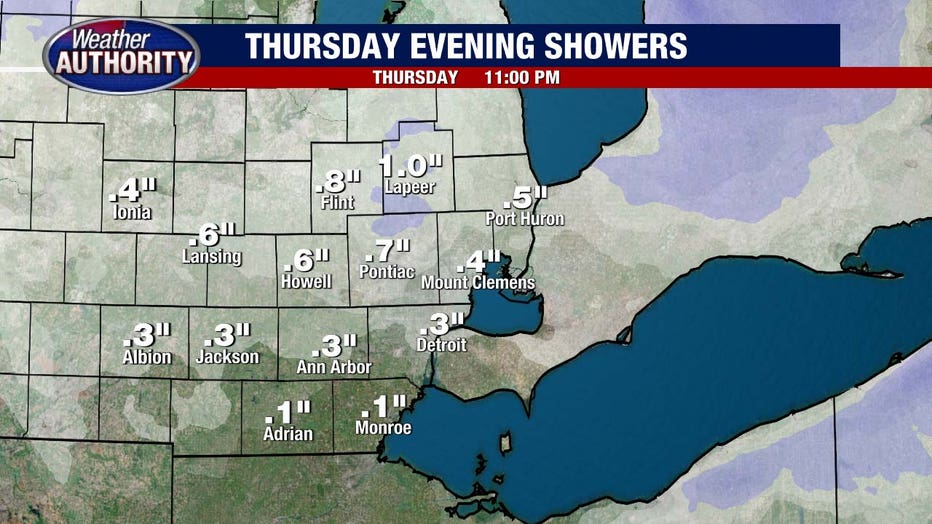
Snow totals will remain under an inch, but heavier showers remain possible Thursday evening.
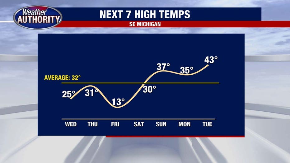
Friday will likely be the coldest day out of the stretch, but a quick rebound lifts us back near 40 degrees Sunday afternoon and the warmer weather will stick into next week.