Rainy morning and dry afternoon Monday in Southeast Michigan before more showers tonight
Hot & Humid Monday
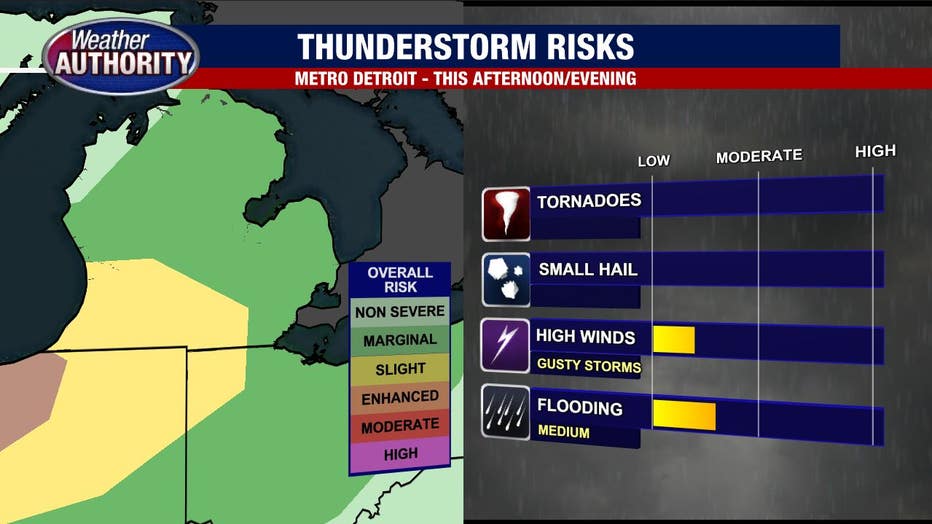
Hot, humid with the threat of storms today in the vicinity of a warm front. Cooler and less humid by mid week. Meteorologist Lori Pinson has your forecast.
(FOX 2) - It's back to school with a distinct summer feel to the day.

An area of rain is moving through for the morning commute. Rain showers are likely with a rumble of thunder possible. That fades by mid-to-late morning with most of the afternoon remaining dry, but storms will move in from the west late in the day.
Check out the storms to our west at 7 p.m.
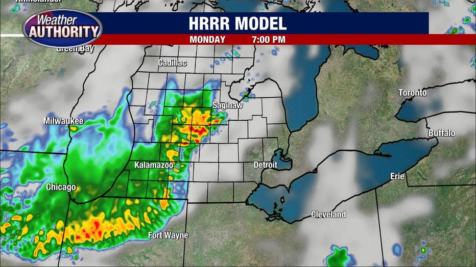
They'll roll through around sunset and beyond. Plan for downpours along with a limited opportunity for strong or severe wind gusts. We are under the marginal risk for severe storms, so an isolated severe storm is possible.
A spotty shower is possible early Tuesday, but generally dry conditions win as our system moves away and high pressure builds in.

Another cold front slips through Wednesday night leading to a highs Thursday struggling to reach 80.