

Metro Detroit weather: Severe thunderstorms possible as feel-like temps spike to 100+
DETROIT (FOX 2) - A lot going on in the world of weather today so buckle up!
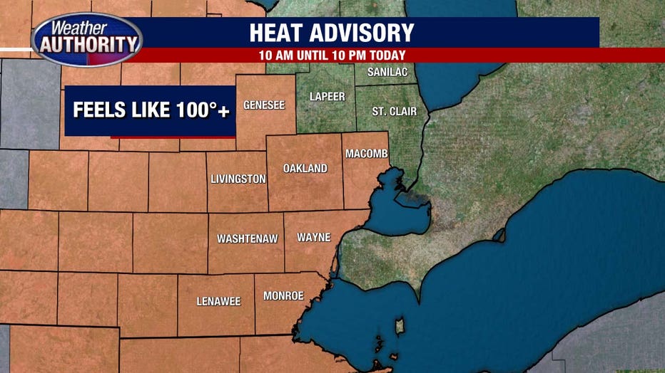
A Heat Advisory will be in effect from 10 a.m. to 10 p.m.
Two primary headlines take us through Tuesday, one is the extreme heat and humidity and the other is the potential for severe weather due to that heat humidity. High temperatures today climb to 93° but with the thick mugginess, it will feel closer to 102.
Instability with the atmosphere means all of the ingredients for active weather are present, but will we have the spark that ignites the thunderstorms? It looks entirely possible that we could see a couple different rounds of storms today.
Through the morning hours, some thunderstorms are possible between 8:00 and 9:00 a.m.. then, and as the heat rises this afternoon more storms are possible continuing through the evening. Models are indicating that some of the most active weather will take place overnight into early Wednesday morning.
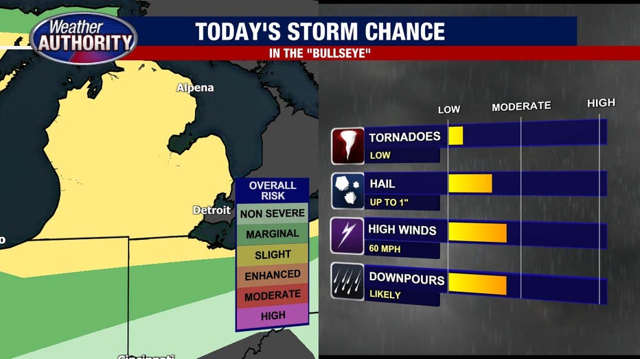
The threats include strong Gusty winds of up to 60 mph with the thunderstorms, large hail up to 1 in in diameter and heavy downpours. An isolated tornado is also a possibility today due to the nature of these storms.
Due to the extreme heat, a heat advisory has been issued until 10:00 p.m. Tonight as well. Do your best to limit your time outdoors!
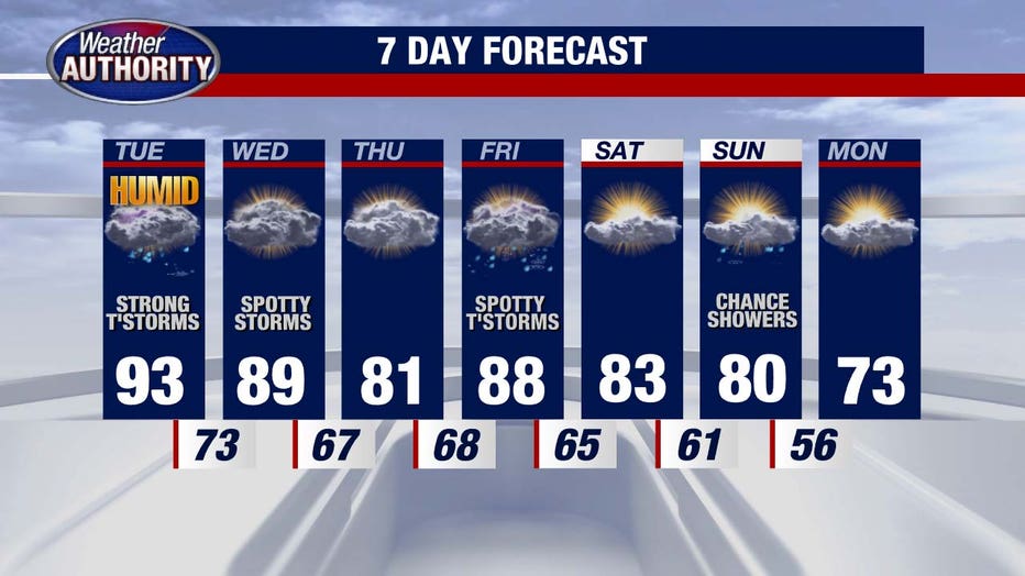
The rest of the week remains hot and muggy with the possible exception of Thursday as temperatures dip to the lower 80s. Storm threats continue Wednesday and Friday before cooler. air arrives in time for the weekend. Next week looks much more comfortable with temperatures in the '70s.